East Haddonfield Map Guide: Official Landmarks
Learn what the official four-map overview confirms about East Haddonfield, including Rabbit in Red, Phelps Garage, farmland, and route-verification limits.
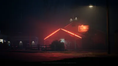
What is East Haddonfield?
East Haddonfield is one of the four maps officially listed for launch in Halloween: The Game. The September 1, 2026 official map overview places it on the outskirts of town and describes a rural agricultural district with farmland, roadside businesses, and a rougher social atmosphere than the conventional neighborhoods. It is the clearest rustic counterpoint to Orange Grove Estates and Haddonfield Town Center.
The current official source for East Haddonfield is the four-map overview, The Locations of Halloween: The Game. It introduces East Haddonfield through a short written section and a video, naming the district’s major locations and its role in the wider Haddonfield setting. Unlike a full tactical guide, the article does not publish a complete overhead layout, a coordinate list, or a route table. This page therefore focuses on the confirmed setting and on how to verify routes after release.
The official homepage describes the game as a 1v4 asymmetrical horror experience set in Haddonfield on Halloween night in 1978. The map overview calls the four launch maps unique multiplayer maps. That establishes East Haddonfield as a confirmed multiplayer setting, but it does not prove that the district is physically connected to the other maps during a match or that Michael’s narrative journey between places is a playable cross-map route.
Which East Haddonfield landmarks are confirmed?
The official overview identifies the following places and groups.
- The Rabbit in Red Lounge is a rowdy, leather-clad biker bar. The article describes broken beer bottles, bare-knuckle brawls, and an atmosphere that attracts residents looking for a night they will not forget. Those details establish the venue’s tone and story identity; they do not confirm a match objective or an always-open escape.
- Phelps Garage provides automotive services and is described as offering some of the best gas prices around. Its presence reinforces East Haddonfield’s roadside and vehicle-oriented identity, but the source does not say where a vehicle appears or how a player must interact with the garage.
- The Castle Hill Rooks are named as a biker gang associated with the area’s unsavory reputation. They are part of the district’s local color in the official description, not a confirmed list of AI enemies, playable characters, or encounter spawns.
- Midwest Feed Company is headquartered in East Haddonfield. The official article calls it an economic anchor that brings financial benefit to Haddonfield and employs many local residents.
- Farmland surrounds the district and separates it from conventional residential neighborhoods. The agricultural setting is the main visual change from the suburban and downtown maps.
These landmarks answer what players can currently identify by name when searching for East Haddonfield. They also show why the map is described as a rustic change of scenery. The official text gives a strong sense of place, but it does not assign a gameplay role to every business, gang reference, or field.
What theme does the official overview establish?
East Haddonfield is presented as an outskirts district where agriculture, roadside services, and rough nightlife meet. The Rabbit in Red Lounge supplies the bar setting, Phelps Garage supplies the automotive setting, and Midwest Feed Company supplies the large-scale agricultural and employment setting. Farmland creates the separation from the town’s conventional neighborhoods and gives the map a more rural identity.
The overview frames Michael’s movement toward home through East Haddonfield, but that sentence is narrative framing. It should not be read as evidence that the game lets players travel from one map to another in the same session, or that East Haddonfield has a fixed entrance from a neighboring district. The official source confirms the story context and landmarks; it does not confirm a connected-world route.
This distinction is especially important when comparing the four launch maps. Haddonfield Town Center is described as a downtown cultural and economic hub. Haddonfield Heights is a quiet residential neighborhood marked by the Strode house, Myers house, Lampkin Lane, and a water tower. Orange Grove Estates is an upscale suburb with large homes, a park, and the Wallace and Doyle residences. East Haddonfield is the agricultural and roadside entry in the official set.
What remains unverified about the map?
As of September 4, 2026, the official East Haddonfield overview does not verify map dimensions, a complete building list, an overhead floor plan, exact player spawn points, escape locations, item or weapon locations, objective order, shortcut connections, route lengths, or an optimal route. It also does not establish whether the Rabbit in Red Lounge, Phelps Garage, Midwest Feed Company, or farmland has a fixed mechanical function in every match.
The lack of a published point list is not a gap to fill with guesses. A roadside business may be a visual landmark without being a required stop. Farmland may appear open without proving that every section is traversable. A named biker gang may explain the atmosphere without proving that NPCs spawn there. Until the released game supplies repeatable evidence, these details remain official setting information rather than tactical claims.
How should you verify routes after launch?
Begin by writing the route question in concrete terms: for example, whether a player can travel between two named landmarks, or whether a visible road connects a garage-side area with a farmland section. Record the platform, game version, date, match type, and the exact starting and ending landmarks. Use a complete recording so the route can be checked for turns, blocked edges, doors, vehicles, and changing conditions.
Repeat the test across multiple matches before describing the route as fixed. Mark any section that changes with objectives, vehicles, items, doors, or role-specific actions. Do not call a route a shortcut simply because it looks shorter from a screenshot, and do not call it optimal without comparing alternatives under the same conditions. If the evidence only proves one traversable path, report it as one observed path.
The same method applies when checking whether a narrative relationship becomes a gameplay connection. Michael’s journey home can explain why East Haddonfield appears in the official overview, but only in-game recordings can establish whether a match begins there, ends there, or uses any particular landmark as an objective or escape. This page will keep those questions open until they can be reproduced.
How does East Haddonfield fit the four-map launch?
The official launch overview lists Haddonfield Town Center, Haddonfield Heights, Orange Grove Estates, and East Haddonfield as the four maps launching with Halloween: The Game. The homepage supplies the wider 1978 Haddonfield and 1v4 context, while the map overview supplies East Haddonfield’s named places and rural theme.
The overview states that the game launches on September 8, 2026, with Digital Deluxe early access starting September 4 at 9:00 AM PT. This page was verified on September 4, 2026. Post-release updates should add route and point information only from recorded, repeatable tests, preserving the difference between an official map reveal and a later community map guide.
Sources
Evidence gallery
Related field reports
maps
Haddonfield Heights Map Guide: Official Landmarks
See what the official Haddonfield Heights flythrough confirms, including the Strode house, Myers house, Lampkin Lane, water tower, and launch-map context.
maps
Haddonfield Town Center Map Guide: Official Landmarks
Learn what the official reveal confirms about Haddonfield Town Center, its downtown landmarks, four-map launch context, and post-release route verification.
maps
Orange Grove Estates Map Guide: Official Landmarks
Review the official Orange Grove Estates reveal, including multi-story homes, the park, Wallace and Doyle residences, and what routes still need launch testing.
Was this report useful?
Response recorded